Indigenous-led monitoring protects wild rice in Great Lakes region
AI-enabled sensors support culturally responsive environmental monitoring of wild rice ecosystems and advance Indigenous sovereignty
Manoomin is a wild rice central to the culture and livelihoods of the Indigenous Ojibwe peoples who live in the Great Lakes area. Once common across the Great Lakes, both in the United States and Canada, manoomin habitat has dwindled due to the interconnected pressures of development, pollution and climate change.
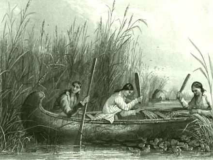
Manoomin is woven into Ojibwe culture. Historically, it served as a staple food, particularly in times when other sources of food were scarce. When there was a surplus, manoomin was traded for goods and services. Today it remains an important food source and continues to be used as a medicine and as a spirit offering during ceremonies — maintaining and sustaining important connections within and among Ojibwe peoples and their lands and waters. For this reason, understanding the effects of the changing environment and finding new ways to protect the grain are urgent tasks.
Researchers supported by the U.S. National Science Foundation are working closely with Ojibwe communities and scientific organizations covering miles of coastal wetlands each season to monitor ecosystems. Together, they are integrating computing into their efforts to support manoomin and the Indigenous culture.
"Manoomin is the keystone connection between people and coasts," said Josiah Hester, an associate professor of computer science, computer engineering and electrical engineering at Northwestern University and Georgia Tech. "It's taken 100 years for rice to go from incredible abundance — over one-third of the continent — to a concentration into just these few places."
Historic knowledge as the base
Hester is working with researchers from Northwestern, Purdue University, Argonne National Lab and the University of Minnesota under a $5 million grant from the NSF Coastlines and People Hubs for Research and Broadening Participation program, which supports multi-institutional coastal research hubs. Over a five-year period, the project is designed to advance science that is rooted in Indigenous knowledge and Indigenous data sovereignty. This project aims to support Indigenous self-determination and community level decision-making and governance.
"We have a sensor network and the hydrology models, but the tribal elders have the stories – that historical knowledge," said Hester. "For example, if someone tells me, 'When floods were tamer and came earlier, wild rice would have a much better season.' That allows us to go from a giant set of ecosystem questions to a few things to really focus in on."
By starting with a framework that values Indigenous knowledge, Hester and his partners are developing a system for coastline assessment intended to better integrate the experiences of Indigenous people and their knowledge with the assessments made by technology to inform the decision-making processes for tribal nations and Great Lakes communities.
With support from a range of faculty at Northwestern University, tribal scientists and field scientists at the Great Lakes Indian Fish and Wildlife Commission, the team spent two years cultivating relationships with and learning from tribal nations and Indigenous researchers from the Bad River, Lac du Flambeau, Fond du Lac and Mille Lacs tribes.
The result of these relationships is a web of resources that provides experiential education for students and community members and data collection capabilities that are critical to understanding changing wetland ecosystems.
"Computing, unfortunately, has been traditionally disconnected from impacts and society, and that's something that we are trying to actively fix," Hester said. "I think NSF programs like Future of Work at the Human-Technology Frontier are seeking to address this, and I think sustainability and community-driven work and computing are all now so interconnected."
Leveraging technology
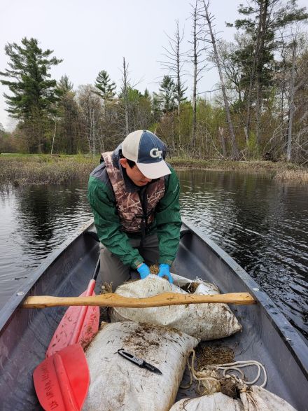
Another challenge is the sheer size of the area being covered. "We just don't have enough people to go around the hundreds and hundreds of square miles and the thousands of rivers and streams that are impacted," said Hester. "So one of our goals is how can we automate some of these functions?"
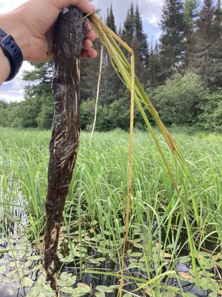
The team has deployed a range of environmental sensors across manoomin wetlands. These sensors are computing nodes capable of taking high-quality 4K images and using advanced machine learning algorithms and edge computing technologies to get fast and accurate results about the wetlands' environment.
"Instead of sending raw data wirelessly via cell towers to the cloud, and then trying to figure out what it all means, we're figuring out the meaning on the sensor itself," Hester said. "For example, something we are working on now – if one of our sensors picks up a goose call, it can recognize that there have been many goose calls in the past 45 minutes in a certain area. This tells us, we need to flag increased herbivory on wild rice at that site. These sensor sites are also set up so that other equipment can be plugged in, so tribal partners can host and exchange sensors they are interested in. That flexibility is very important to be responsive to changing climate factors."
Other sensors are lighter weight and can be quickly set up with a solar panel array to collect data over shorter time periods. Sensors will be complimented by a phone application designed for community scientists to easily upload information and images on the go. Together, these data sources can capture a huge range of environmental conditions, including air quality, 3D stream flow, water velocity, turbidity and boat wake, with new ideas being tested as the team learns more from tribal knowledge keepers.
Paired with remote sensing data from federal agencies such as the National Oceanic and Atmospheric Administration, this network delivers a robust, live view of the manoomin habitat and how wetlands are changing.
"I view the cyberinfrastructure we are building as an ecosystem assessment and monitoring tool. Right now that ecosystem is centered around the wild rice but could be focused toward monitoring other plant and animal relatives," Hester said. "In some sense, the data already exists. We have a big capture field of view. It's up to us and the tribes on what we focus on within that big field of view. In terms of Great Lakes management overall, I think these methods and cyber infrastructure advances will significantly push forward smart Great Lakes capabilities for adaptation, and lead to enhanced resilience strategies, by providing a method and system for real time coastline assessment. This cyberinfrastructure can positively impact everything from emergency warning systems to commercial operations as well as conservation."